


Vessel Tracking - Ship Radar
4.4218.00 Reviews
App Specs
- Version
- 1.3.0
- Updated On
- License
- Free
- Downloads
- 500,000+
- Developer
- Rocketech sp. z o.o.
- Categories
- Maps & Navigation
- Platform
- Android
Screenshots
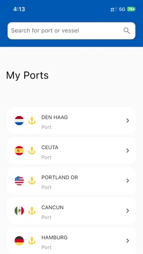
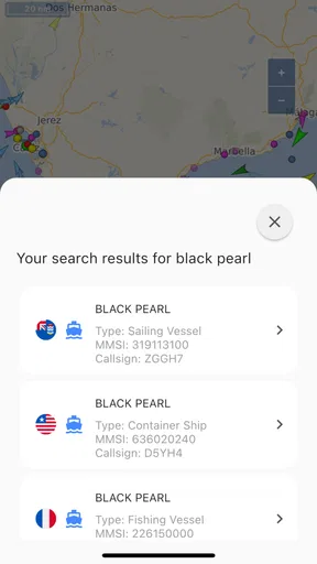
 Analysis by AppCompare
I find ship-tracking apps most useful when I have a particular question: What is that vessel near the harbor? Has a cruise ship reached its next port? Which ships are moving through a busy stretch of water? Vessel Tracking - Ship Radar is aimed at exactly that sort of curiosity, putting maritime traffic on a map instead of making you piece together answers from scattered sources. Its appeal is part practical lookup, part fascination with seeing how much activity is happening offshore.
That focus also sets a sensible expectation. This is a Maps & Navigation app, not a replacement for professional navigation equipment or an official source for making safety-critical decisions. I’d use it to follow vessels and explore their movements, not to plan a voyage or assume that every map position is an exact live location. That distinction matters whenever a display looks precise: a tracking map is helpful context, but it should not be treated as a guarantee.
Who gets the most from a ship-tracking map
The strongest fit is someone who enjoys maritime traffic or has a specific ship to follow. A family member waiting for a cruise passenger, a coastal visitor trying to identify a vessel, or a shipping enthusiast studying routes can all get more from a map than from a plain search result. The map gives movement a visual context: you can see where a ship is in relation to the coast and other traffic, rather than looking at a name in isolation.
There’s also a useful low-effort way to explore. Start with a place you already know, zoom out to see the traffic around it, then select a vessel that catches your eye. That makes the app approachable even if you don’t know ship names or maritime terminology. If you’re opening it just to browse, choosing a familiar harbor first gives the map a reference point and makes the density of traffic easier to interpret.
A practical routine for following a vessel
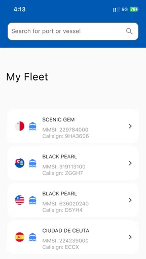
For a real everyday example, imagine a relative is travelling by cruise ship and has shared the vessel’s name. I’d search for that ship, check its position and destination, and then set an alert if I want a prompt to check its progress later. The useful habit is to save the vessel or set up the notification while I have time to confirm I’ve selected the right match, rather than trying to identify it in a hurry when someone asks for an update.
Alerts are most valuable when they reduce repeated checking, not when they turn the app into a constant source of interruptions. I’d reserve them for a small number of ships I genuinely care about. For casual browsing, opening the map when I’m curious is simpler; for a trip with a meaningful arrival or departure, an alert can make following along less hands-on. Either way, I’d still confirm travel arrangements through the operator or the traveller, since a map is not a substitute for an official schedule.
Where it differs from general map apps
A standard road map is built around streets, directions and places on land. Ships25 is more focused on vessel discovery and maritime context, so it makes more sense when the question is about traffic at sea than when you need to get somewhere yourself. It can complement an ordinary map—for example, by helping identify activity offshore—but it isn’t the tool I’d choose for driving, walking directions or finding everyday businesses.
Worth Reading Before You Choose

EA SPORTS FC Mobile 26 Is a Bigger Football Game, but It Takes Time

Flipboard Shows What News Apps Must Do Beyond the Feed

Switching to Android Auto Means Rethinking Your Driving Routine

Google Calendar Makes a Crowded Week Easier to Manage

Ludo King Makes the Most of the Minutes Between Plans

Baby Panda World Brings Quick Play to Modern Phones, but Its Game Library Feels Busy
Compared with a text-based ship lookup, the map view is the main advantage: it lets you scan an area and notice traffic you weren’t specifically searching for. The trade-off is that a map can feel busy, especially around ports, and browsing without a target may be less efficient than entering a known vessel or location. Filters help narrow what you see, but I’d treat them as a way to focus attention rather than proof that the resulting view includes every vessel of a particular kind.
What I would check before relying on an alert
Before acting on a notification, I’d open the vessel details and make sure the name and destination match the ship I meant to follow. Similar names and busy routes can make a quick glance misleading. I’d also use the destination and speed as context, not as a promise about arrival time: route conditions and schedules can change, and tracking information is best read as a snapshot of reported movement.
This is especially important if you’re meeting someone at a port. The app can help you keep an eye on a vessel, but I wouldn’t leave for the terminal based only on a dot moving across the screen. Check the cruise line or port’s own instructions for the details that matter to a pickup. That small extra step keeps the map useful without asking it to do a job it was not designed to do.
Another practical trade-off is attention. Vessel filters can make a crowded map easier to browse, but narrowing the display too aggressively may hide the broader traffic pattern that makes the view interesting. I’d switch between a filtered view for finding one class of ship and a wider view for understanding what is moving through the area. That is a better use of the controls than leaving one setting on and assuming it suits every search.
If your interest is mainly historical shipping patterns or maritime news, I’d treat those as occasional browsing rather than the central reason to install the app. A dedicated news source may be better for detailed reporting, while a tracking map is more immediate for locating vessels and seeing activity geographically. The right choice depends on whether you want to read about shipping or watch where ships are moving.
There are good reasons to skip it, too. If you rarely look at ships, need dependable turn-by-turn directions, or require operational information for work at sea, this isn’t the right primary tool. And if you only want one arrival update, a carrier’s own communication may be more direct than learning a separate tracking interface. The app earns its place when the map itself is useful to you, not simply because it contains a lot of maritime detail.
Setting Sail with Vessel Tracking
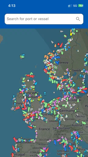
Once you launch the app, you'll be greeted by a sleek interface that's surprisingly user-friendly. Even if you're not a tech whiz, navigating Vessel Tracking - Ship Radar feels like a breeze. The app offers a real-time view of ships all around the world, and it’s stunning to see just how busy our oceans are. I was immediately hooked, watching little ship icons move gracefully across the digital seas.
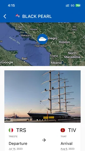
One of the first things you'll notice is the interactive map. It's incredibly detailed, allowing you to zoom in and out, and even rotate to get the perfect view of the maritime traffic. You can tap on any ship to get more information, which includes the vessel's name, type, destination, and even its speed. It’s like having a mini maritime control center in your pocket.
Features That Make Waves
Now, let's talk features because this app is packed with some pretty nifty ones. For starters, you can set up notifications for specific vessels. Imagine tracking a friend or family member's cruise ship and getting updates as they sail across the ocean. It’s a feature that adds a personal touch and keeps you connected, even from afar.
The app also allows you to filter your search by vessel type. Whether you're into cargo ships, cruise liners, or naval vessels, you can customize your view to match your interests. This feature makes it easy to track exactly what you're interested in without the clutter of other ships on the radar.
Another cool feature is the augmented reality mode. Yes, you heard that right! Point your device at the horizon, and the app overlays ship information in real-time. It's like turning your phone into a futuristic pair of binoculars. For maritime enthusiasts, this is nothing short of magical.
Charting the Course
The app isn't just about watching ships move; it’s also educational. There's a section dedicated to maritime news and updates, keeping you in the loop with the latest happenings in the shipping world. Whether it's about new shipping routes or interesting maritime trivia, there's something to feed your curiosity.
Moreover, the historical data feature lets you look back in time and see how shipping patterns have changed. It's fascinating to observe how certain routes have evolved and how global events impact maritime traffic.
Smooth Sailing or Rough Seas?
As much as I love the app, no app is without its quirks. Occasionally, the app can lag, especially if you're zooming in and out rapidly. This isn't a deal-breaker, but it can be a bit frustrating if you're trying to track a fast-moving vessel.
Another thing to note is that while the basic version of the app is free, some of the more advanced features require a premium subscription. It's something to consider if you're planning to use the app extensively.
What its current version tells me
Ships25 is developed by Rocketech sp. z o.o. and has been available since November 4, 2023. Its current version is 1.1.10, and that gives me a useful point of reference: this is an app with a defined release history, but I wouldn’t infer a particular feature overhaul or performance change from a version number alone. For existing users, the practical approach is to check what changes in an update before expecting the map, alerts or other tools to behave differently.
The version matters most as a compatibility check. The app requires Android 7.0 or later, so anyone using an older device should verify compatibility before planning around it. It is free to install, with in-app purchases ranging from $7.99 to $59.99 per item. I’d explore the free experience first and only consider a purchase if a feature I actually use is behind it; the listed range is broad enough that it makes sense to check the specific item and terms in the app before paying.
Its audience is broad: the content rating is Everyone, which fits a utility centered on maps and vessels rather than mature entertainment. The app has a 4.6 average from around 26,000 ratings and has passed 500,000 installs. Those figures suggest plenty of people have tried it, but they don’t tell me whether it will suit my own routine; the better test is whether I want to follow ships often enough to justify keeping a dedicated tracker on my phone.
What I’d watch as the app evolves
For people already using the app, the most meaningful improvements to watch for would be changes that make vessel identification clearer, keep map browsing responsive, or make alerts easier to manage. Those are the areas that affect ordinary use directly: finding the right ship in a crowded harbor, following it without repeatedly searching, and understanding what a notification is telling you. I would welcome progress there, but I wouldn’t assume a particular change is coming until it appears in the app’s release notes.
There is a related question about how much confidence to place in a displayed position. I’d use the map to follow the broad course and check vessel details, while leaving time-sensitive decisions to an official operator or port source. That is not a reason to dismiss the app; it is a sensible boundary for any consumer tracking view. When the stakes are simply curiosity, a delayed or imperfect picture is still interesting. When someone’s travel plans depend on it, independent confirmation matters.
The current experience also asks users to balance exploration with focus. A broad map is rewarding when I want to discover what is moving nearby; a vessel search and a carefully chosen alert are more efficient when I already know what I’m looking for. Switching between those habits is a small but useful workflow: explore first, identify the ship, then follow only what matters. It avoids turning every session into a long scan of the whole ocean.
Final Thoughts
In the grand scheme of things, Vessel Tracking - Ship Radar is a gem for anyone fascinated by maritime navigation. It's packed with features that cater to both casual users and serious maritime enthusiasts. Despite a few minor hiccups, the app delivers a comprehensive and engaging experience that brings the world of ships right to your device.
So, if you're ready to set sail on a digital adventure, this app is definitely worth a spot on your home screen. Whether you're a seafarer at heart or just curious about the bustling world of maritime traffic, you'll find plenty to explore and enjoy with this app. Happy tracking!
Pros
- Real-time ship tracking.
- User-friendly interface.
- Comprehensive vessel database.
- Customizable alerts.
- Offline mode available.
Cons
- Requires internet for updates.
- Limited free features.
- Ads can be intrusive.
- Occasional data lag.
- Subscription cost for full access.
FAQs for Vessel Tracking - Ship Radar
What is Vessel Tracking - Ship Radar and how does it work?
Vessel Tracking - Ship Radar is an app designed to provide real-time tracking of ships and vessels worldwide. It uses AIS (Automatic Identification System) data to display ship movements on a map, allowing users to monitor vessel locations, routes, and speeds. The app is useful for maritime enthusiasts, professionals, and anyone interested in marine traffic.
Is Vessel Tracking - Ship Radar free to use, or does it require a subscription?
The basic features of Vessel Tracking - Ship Radar are typically available for free, allowing users to track vessels and view basic information. However, for more advanced features such as historical data access, detailed vessel information, and ad-free experience, a subscription or in-app purchases may be required.
What features does Vessel Tracking - Ship Radar offer?
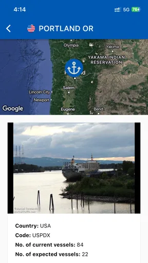
Vessel Tracking - Ship Radar offers features such as real-time ship tracking, detailed vessel information, route history, and customizable alerts for specific ships. Users can also view port arrivals and departures, weather conditions at sea, and set up notifications for vessel movements. The app is designed to cater to both casual users and maritime professionals.
What are the system requirements for installing Vessel Tracking - Ship Radar?
Vessel Tracking - Ship Radar is available for both Android and iOS devices. For Android, it typically requires a device running version 5.0 (Lollipop) or higher. For iOS, the app usually supports devices running iOS 10.0 or later. Ensure your device has sufficient storage and internet access for optimal performance.
How accurate is the data provided by Vessel Tracking - Ship Radar?
The app relies on AIS data, which is generally accurate and updated frequently. However, the accuracy can vary based on factors such as the vessel's location and signal coverage. Coastal areas typically have better coverage compared to open ocean. Users should consider these factors when relying on the app for critical information.


